The Cartograph app is a multi-platform map viewing and track recording app especially focusing on Mapsforge maps. The app is fully compatible with OpenAndroMaps.org maps and themes. You can download the app for Android, iOS, macOS, and Windows here.

Are you missing a feature or do you have a question? Just contact us!
Maps
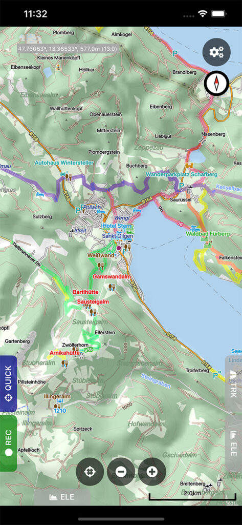
- View Mapsforge offline vector maps (full support for OpenAndroMaps.org maps).
- Support for OpenAndroMaps render themes (Elevate, Elements), which are great for hiking, mountain biking, running, and other outdoor activities.
- Other supported offline map formats: MBTiles (raster and OpenMapTiles MVT vector), TwoWays RMAP, Locus SQLite, Oruxmaps SQLite, Garmin IMG (only non-NT, non-DRM protected maps).
- Supported online map types: Mapbox vector tiles (MVT – OpenMapTiles style), Bing quadkey tile format (raster), OpenStreetMap slippy tile format (raster), raster WMS (web map service, including layers and styles), WMTS.
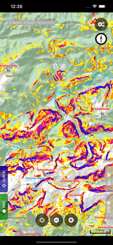
- Offline hill shading and offline slope mapping (e.g. useful for ski touring).
- Mapsforge multi-maps (combine multiple Mapsforge maps into a single map).
- Stack multiple map layers on top of each other (including transparency).
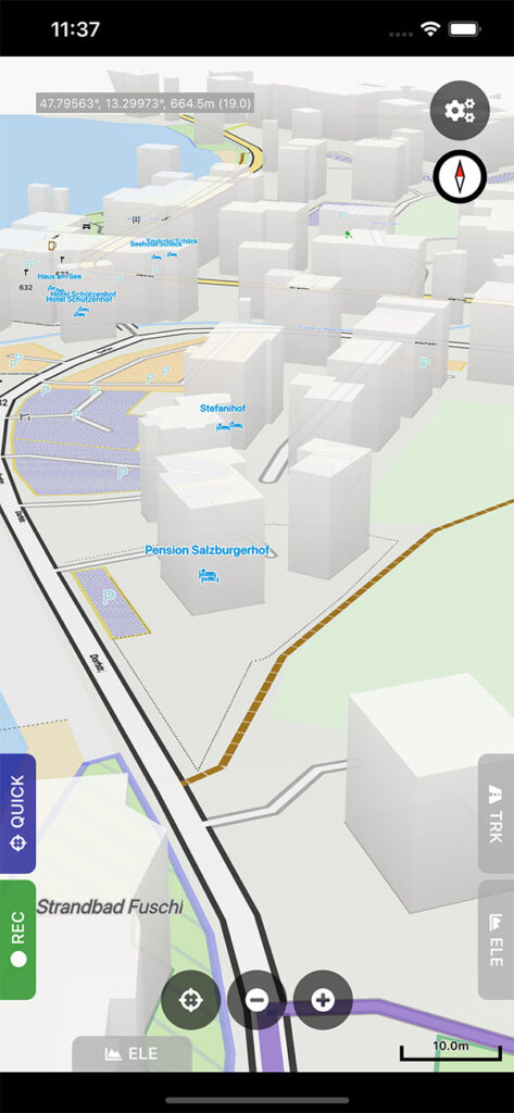
- 3D buildings.
- Create custom Mapsforge maps directly in the app (Custom Mapsforge Maps creation tool).
- Grid overlays, including WGS84, UTM, MGRS (military grid reference system), and many local projections.
- Supports classical latitude/longitude (WGS84), UTM, MGRS, and many local (proj4) coordinate display projections.
- Online map tile downloader.
- Image to map calibration tool (starting with Cartograph Maps 3.1.3).
- 3D map snapshot view (starting with Cartograph Maps 3.3.8; not available on macOS).
- Free hand drawing tool (since version 3.4.2).
- Zoom lock.
- KML overlays (tracks, waypoints, “NetworkLink” tags),
Track and routing
- Track recording while the app is in background.
- Draw custom tracks using the track drawing tool.
- Photo-, video-, and audio way points.
- BRouter offline route calculation.
- OSRM routing.
- Google Directions, Bing Routes.
- Basic offline navigation with voice instructions and custom audio instructions.
- Way point alerts.
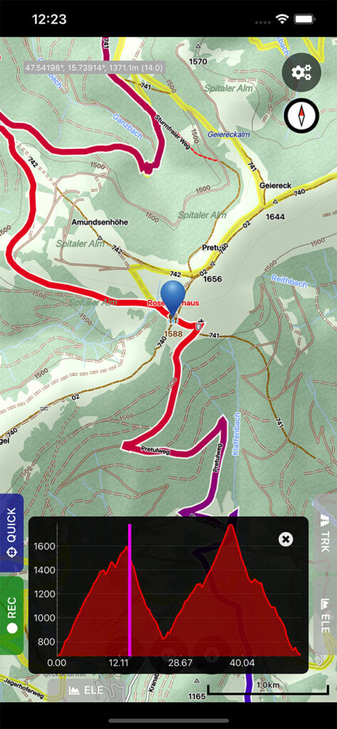
- Current route elevation profile.
- Import and export *.gpx, *.kml, *.kmz (only import), Garmin *.fit tracks and courses.
- Import EXIF JPEG photos and Google Takeout as bookmarks.
- Garmin icon support.
- Live friend tracking (share your location with friends live on a map).
- Track upload to Strava, VeloHero, OpenStreetMap, own web server (since Cartograph 3.4.3).
Other features
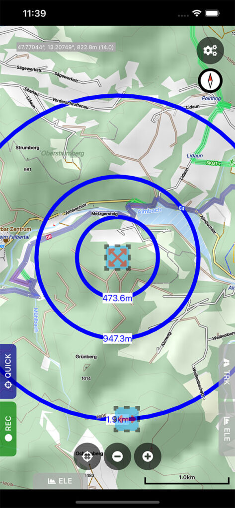
- Measurement tools (distance, elevation profile, circular distance).
- Work spaces (manage sets of maps/overlays/tracks).
- Cloud sync (backup data and synchronize data among multiple devices).
- “What’s here” (reverse geo-code).
- Built-in offline overlays for drinking water, supermarkets, hostels, and restaurants.
- Search for addresses, places, and other points of interest with Google Places, Bing, Nominatim.
- Search for track segments on Strava, OpenStreetMap, custom web server.
- Supports WunderLINQ and Carpe Iter control.
- Create custom map plugins for your own map types.