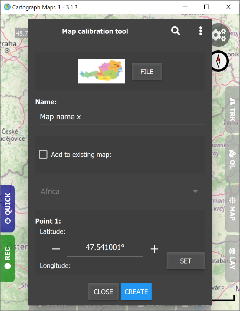
Image to map calibration tool
Cartograph Maps 3.1.3 and newer ships with a raster image calibration tool which creates maps from raster images, such as photos or scans from maps.
The tool is available under “Tools” in the main app menu.
The tool works as follows:
- Select an image file or take a picture (if supported on your system). For best results, the four points should form a shape close to a rectangle.
- Select 4 calibration points on the image. These are used for calibration and should be significant (for instance railway crossings, mountain peaks, etc.).
- Select the corresponding position of the 4 calibration points on the map.
- Press “Create” for creating a calibrated map.
The following video shows the calibration process:
Hi, I just bought this nice programm.
For a perfect calibration, it would be great if it were possible to pan and resize the map to be calibrated, transparently over the background map.
Thanks for your feedback. I have noted down your idea.
Any chance to make the program automatically recognize and import raster maps calibrated for Ozi Explorer or other old school programs? (image file + calibration data file)
Please contact me here (also include a download link to a sample map): https://www.cartograph.eu/v3/contact/