Custom Mapsforge Maps creation tool
The custom Mapsforge maps creation tool built into the Cartograph app allows you to create custom maps which are compatible with OpenAndroMaps themes and include contour lines.
The tool can be access in the “Map manager” in the “Offline” tab. Then press the “+” button and select “Custom Mapsforge map“.
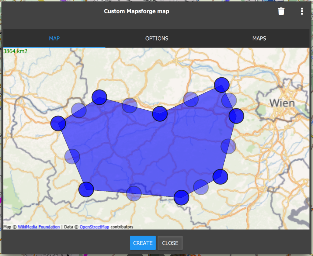
You can select a map region by dragging around the blue circle markers. Press the “Create” button for starting the map creation process. Maps are created on our web server and creation usually takes a few hours (larger maps take more time).
The following options are available:
- Email: Please enter a valid email address. You will get a notification email when the map processing has finished.
- Name: The file name of the map.
- Languages: A list of languages supported by the map.
- Contour lines: Check this if you want to enable contour lines in the map (requires an OpenAndroMaps theme).
- Simplify contour lines: This option interpolates contour lines which is often leading to better visual results and smaller files.
Note: The custom map creation tool requires additional credits: In-App-Purchase Info.
How to display contour maps with cartograph maps?
You have to use a Mapsforge map with a theme which supports contour lines, for instance the OpenAndroMaps.org Elevate theme: https://www.openandromaps.org/en/legend/elevate-mountain-hike-theme
I tried OpenStreetMaps and Elevate5 and Elevate2, but they all did not work. Please tell me how should I do.
Please contact me here so that we can sort out the problem: https://www.cartograph.eu/v3/contact/
My guess is that you have not loaded a Mapsforge vector map, but you are only showing the OpenStreetMap online map (which is a raster map).
Sorry, I have not Twitter account. In fact, I use offline osm map (osm China map) with style Elevate 5 (or 2).
By the way, when I use the same map and the same style with Locus maps equipped with dem data, the contour lines display normally.
I have sent you an email.
ذهب